近所にこのような看板があることが以前から気になっていました。
There is such a sign near my house.
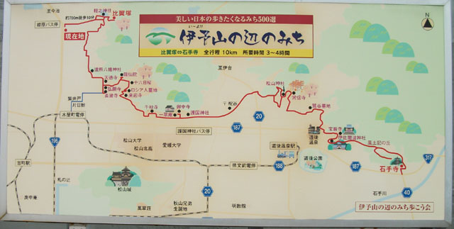
いかにもウォーキングのコースに最適!みたいな雰囲気だし、 10km という工程は休日にちょっと気合い入れて歩くにはちょうどいいんじゃないかと思って挑戦してきました。
It was a course setting as if we recommended hiking, so we tried walking along this course. The distance is about 10 km so I can walk to the end with my strength.
歩いた行程をウォーキングの友、Garmin Fortrex 301 で記録してきました。経路をあらかじめストリートビューとかで予習しておけば 正確なルートをたどれるんでしょうが、今回は敢えて看板の地図だけをヒントに迷ってみました。 こうして経路を比べてみたところ、看板のルートが見やすいように縦横比や込み入ったところを整理しているのを考えると だいたい正確に歩けているような気がします。
The route which I walked this time is recorded by GPS and embedded in Google Maps above figure.
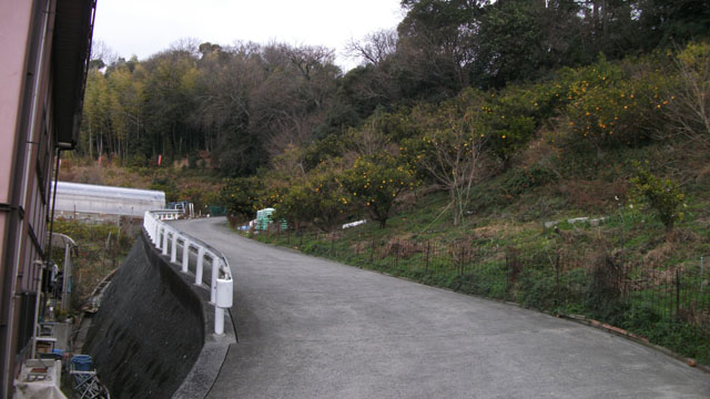
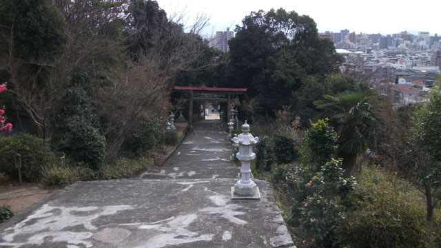
最初はパチンコ屋の横からため池を目標に歩きます。今回のルートは距離的に自転車のほうが楽かと思ったのですが、 前半ルートが山の斜面に沿った箇所が結構あるので徒歩にしたのですが、結果としてこれが正解でした。
I suggested to move on this course by bicycle, but we decided that walking is easier as there are many slopes near the starting point. Considering the route of the second half, this judgment was right.
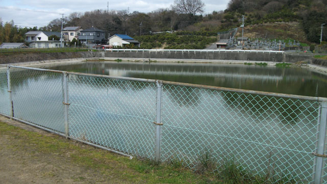
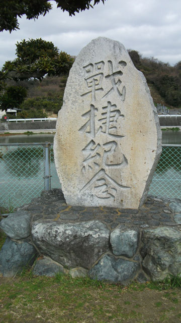
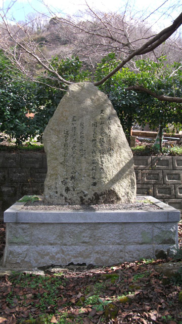
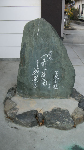
写真は撮り忘れたのですがため池の脇には「軽之神社」なる神社が建てられています。
古事記に登場する
A stone monument is built near this pond which is the first target. I searched for this stone net on the net, but detailed information could not be obtained.
で、画像の碑については調べたのですがあまり具体的な資料が見つからず。 池の完成記念の石碑でしょうか。
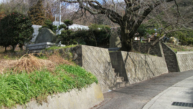
ため池から少し山側に歩くと比翼塚があります。
先の
There is "Hiyoku-zuka" by the pond. This mound dedicated to brothers, "Kinashi Karunomiko" and "Karuno Oiratsume" written in ancient book "Kojiki".
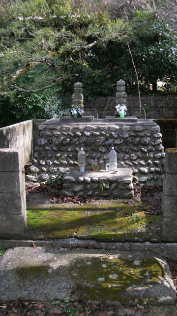
塚自体はこじんまりとした感じです。
塚の隣には古事記に記録された歌の碑が建てられています。
軽太子「天飛ぶ鳥も 使ぞ鶴が 音の 聞えむ時は 我が名問はさね」
軽大娘「君が行き け長くなりぬ 山釿の 迎へを行かむ 待つには待たじ」
塚の向かいには句碑が建てられています。 「天さかる ひな乃伊予路に 永久乃 愛に生きたまふ 二柱の神」
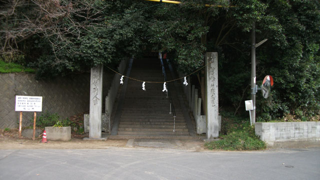
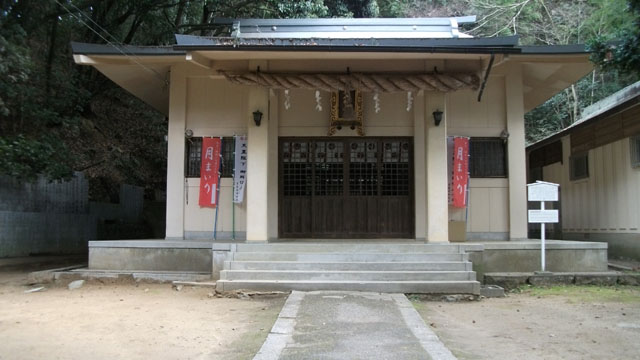
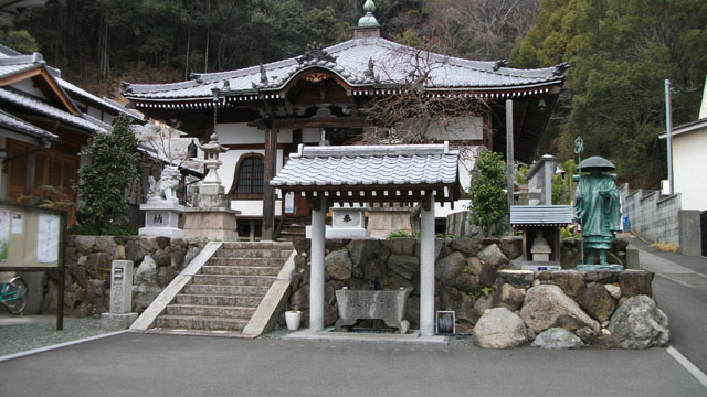
軽之神社から山沿いに南下すると
Proceeding south from the pond you will reach the shrine "Kaeriguma Hachiman".
ただし、国道 196 号からくる場合はバス停からまっすぐ歩くだけなのでわかりやすいのですが、 今回のルートで訪れる場合は住宅地の中の込み入った道を歩くことになり、しかも山の斜面沿いなので アップダウンが激しくて無駄に疲れることになります。 多少遠回りになっても一度スタート地点まで戻って国道から迂回することをお勧めします。
This shrine is famous for the fact that a bus stop is set up, and the place is easy to understand when walking from the national highway. Since the route shown in this course goes through a narrow residential area, it is better for people other than local people to bypass and go through the national highway.
道から見上げると木々に隠れていて上の様子はわかりにくいのですが、国道からまっすぐ参道が伸びているので何かあることはわかりやすいです。
神社はあまり豪勢ではないこじんまりとした事務所風です。公民館だといっても違和感ないです。
Although it is a famous shrine, the size of the building is not big. If you do not have knowledge in advance, you may misunderstand that it is a general office.
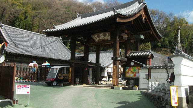
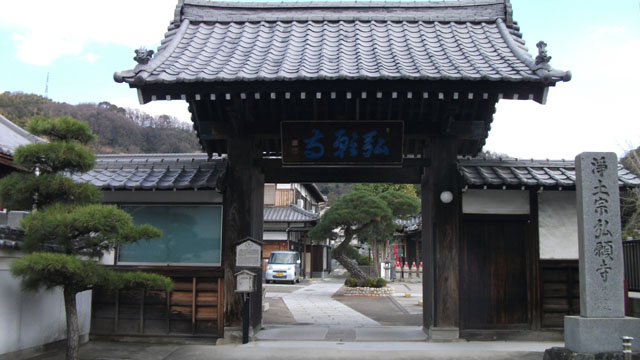
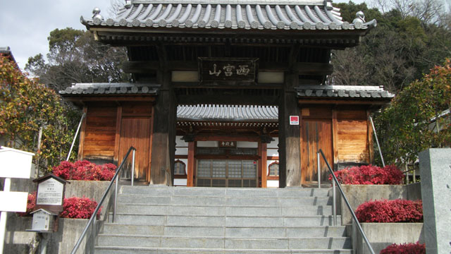
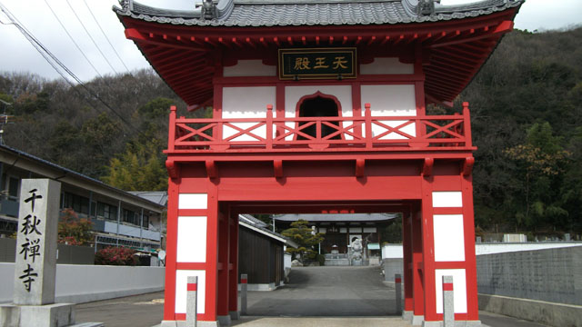
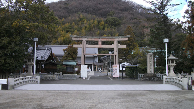
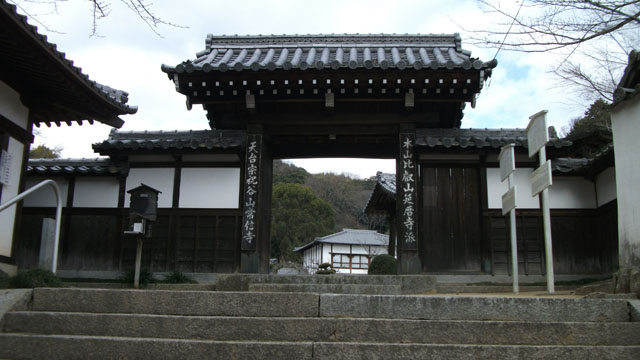
ここから護国神社まではお寺巡りのコースになります。 門前には愛媛ゆかりの俳人による句碑や別件の企画である道後村めぐりのスタンプがあるのですが、 ウォーキング目的であればこれらはスルーして護国神社までノンストップでもいいと思います。
Between "Kaeriguma Hachiman" and "Gokoku Shrine" it is the route that goes around many temples. Some of this temple has set up stamps to use in other projects, but we recommend that you go directly to "Gokoku Shrine" through these temples unless you participate in this project.
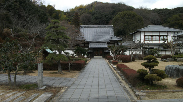
まずは天徳寺です。
This is "Tentokuji".
お寺の敷地内に幼稚園を併設していて、還熊八幡から来る際には幼稚園の黄色い壁が目標物として大変わかりやすいです。 幼稚園はかなり大規模で、お寺の敷地とは別の場所にグラウンドがあったり、一時保育用の別館があったりでマジかよ!って感じです。
This temple runs a kindergarten and has a large site. It is a large-scale organization managing kindergartens not only on the site of the temple but also at the ground and another building.
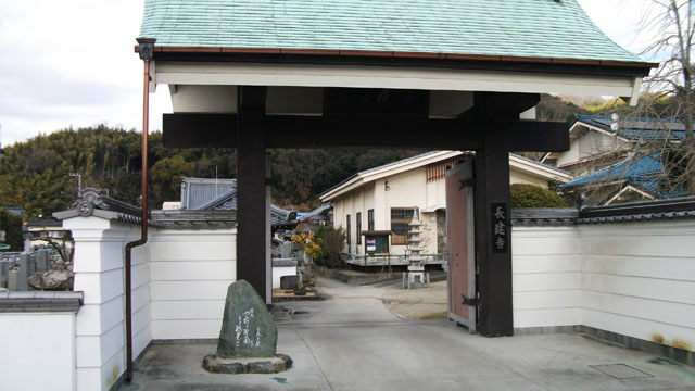
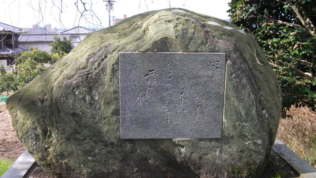
天徳寺からまっすぐ南下すると大川と交わるあたりにあるのが長建寺です。 特に見どころはないのですが、門前に句碑が置かれているほか、お寺の中にもいくつか句碑があるそうです。
門前に 野菊さきけり 長建寺
上の句は解説しているサイトからのコピペですが、解説を読んでも何と書いてあるのか読めない…
長建寺から折り返して少し戻ったところにあるのが
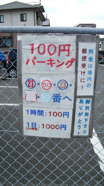
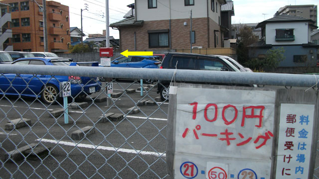
途中にあったコインパーキング。料金を自己申告でポストに投入するという超アナログな仕組みです。 野菜の無人販売かと。
地図上だとちょっと迂回して山に登るような書き方ですが、実際のルートはわかりづらいうえに半端ない登り坂なので 足腰に自信のない方はスキップして長建寺から直接ロシア兵墓地、または千秋寺方面に向かうことをお勧めします。
This place is written to bypass a little on the map, but the actual route is a very difficult road that has to climb a steep slope. If you are not confident of your physical strength, you better go to the next goal without visiting this place.
ルート的には天徳寺南側の墓地の南側から東進し、そのまま坂道を上へ上へと進みます。
If you truly are going to this place, proceed the road south of "Tentokuji Temple" and go along the slope along the road.
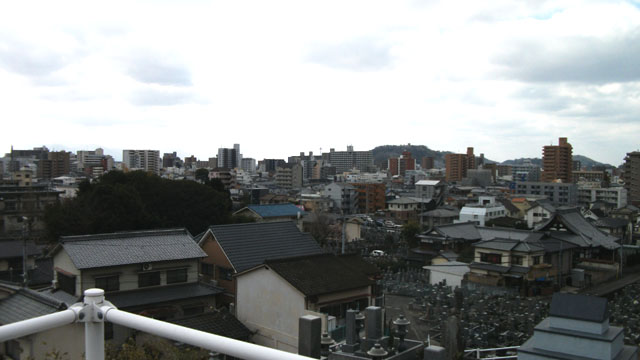
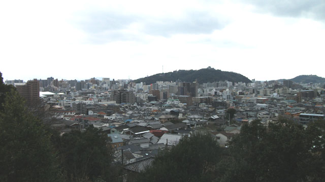
頑張って坂道を登りきると松山市の街並みの北半分を一望できる素敵な眺めが待っています。 写真は残念ながら曇っているのですが。
Try hard and climb the slope to reach a place where you can see the city of Matsuyama.
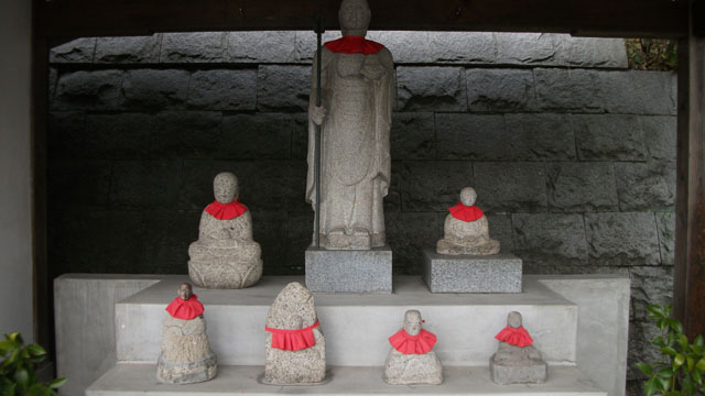
頑張って登りきると「おこり地蔵」がお出迎えしてくれます。 住職のお祖母さんが戦中に広島在住中に損傷したお地蔵様を回収し、補修したものだとか。 愛媛に持って帰ってきてしまったのはいいのだろうか?
This kind of Jizo welcomes you at the temple of your choice. It is said that this Jizo restored damaged things during the war and brought home.
龍仙院への登山を果たした後はしばらく下りなので楽ちんです。 地図ではロシア兵墓地までの道のりに「十六日桜」なる桜の木があるらしいのですがわかりませんでした。
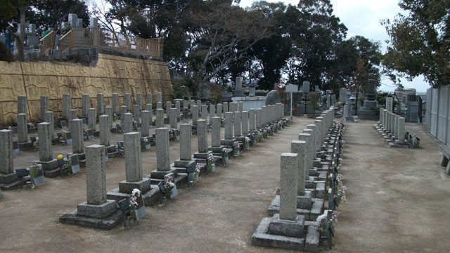
日露戦争の際に捕虜となったがロシア兵を葬った墓地です。 現在は奇麗に整備されていますが、設立当時から改修されているそうです。
This is a cemetery burying a Russian soldier who died in Japan as a prisoner of the Russo-Japanese War. Since its establishment, maintenance and renovation are being carried out and it is still kept upright now.
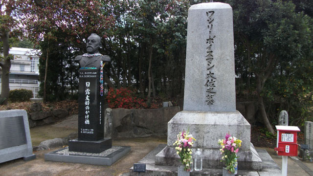
墓地の中でも特別な待遇で葬られているワシリー・ボイスマン大佐の墓とその胸像。 「坂の上の雲」でおなじみ秋山眞之が戦ったロシア軍艦隊で艦長を務めた人だそうです。
Tomb and bust of Col. Wassily Voismann who commanded Russian warships.
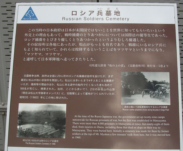
墓地の脇に建てられた説明の看板。 捕虜に対して人道的な扱いの模範となったことはいいんですが、見方を変えれば 外交的な見栄のために疲弊した国民を無視して捕虜のおもてなしに膨大な国費をつぎ込んだって事ですよねこれ。
Commentary is set up beside the cemetery. During the Russo-Japanese War, Japan had very humane treatment of prisoners of war, and its treatment was highly appreciated by Russia.
軍部の影響力が膨れ上がって太平洋戦争の破滅に向かう伏線を感じますな。
ロシア兵墓地から坂を下りて法華寺を左折します。松山大学のキャンパスとグラウンドの間を抜けて道なりに進むと大川に出るので、 ここを再度左折して東へ進み、次の目的地である来迎寺、御幸寺、そして愛媛縣護国神社に向かいます。 護国神社以外は路地に入った奥にあるため、案内板は出ているものの話しながら歩いていたりすると見落としやすいので要注意です。
Get off the slope along the road from the Russian Cemetery and turn left at the intersection with the river. Next, pass between the facilities of the university, and turn left again along the river. Since the next destination "Raigoji" is in a place that is easy to overlook from the road, you should carefully compare it with the map.
法華寺から左折するとすぐにこの
The next destination is "Raigoji". When going along this route, you can see the gate of the cemetery during the road, so you can go on with this goal.
来迎寺から大川沿いに進み、「天竜ファイアペック」なる会社の脇に入ると次の目的地、千秋寺の裏手の墓地があります。 画像の門をはじめとして裏手は工事中のようで、墓地の前に塀も無く門だけが立っている状態でした。
The fence was being removed as construction around the cemetery was under construction. Because there is no wall, the gate is not useful.
墓地からご立派な境内に出ることができます。
実は前述したファイアペックの脇を通らなくても大川沿いにもう少し進めば立派な正門があるのでした。
If you go in the direction opposite to this route, you can see a fine gate first like this, so it will be a meaningful goal.
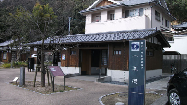
次の目的地である御幸寺の隣にある一草庵です。俳人、種田山頭火が住んでいたという庵。 一草庵は左奥に見えている小さい建物で、正面に見える建物は松山市によって整備された公衆便所兼解説展示室です。
The next destination is "Miyukidera" and "Issoan" set next to the temple. "Issoan" is a facility built by "Taneda Santoka" and is now used to gather people who enjoy haiku in this area. Previously aging was progressing, but now it was maintained by Matsuyama City and a public toilet was also set up.
一草庵の玄関先の図。中で句会が開かれていたらしく人がいたので、若干おかしなアングルで撮っています。
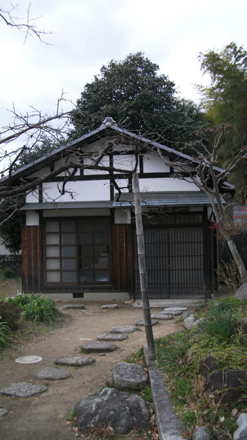
御幸寺です。一草庵の隣にあります。
境内に入ると正面がお堂、左側は住宅になっているので写らないように。
愛媛縣護国神社。愛媛県出身の殉職者、功労者、はたまた文化人を合祀した神社でありますが、 政治的な云々はさておき初詣から七五三のお祝いまで様々な人が訪れる神社です。
This is "Gokoku Shrine". This is a shrine dedicated to those who died in Ehime prefecture and people who raised great achievements.
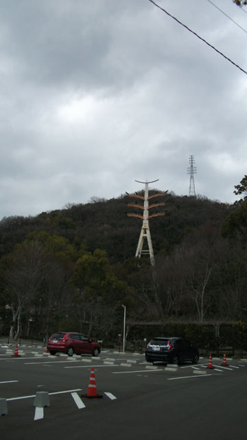
護国神社の駐車場北側に立っているやたらと立派な送電線の中継塔? オープンワールドだったら絶対登れてジップラインで降りられるタイプの奴だわ。
Such a tower was built next to the parking lot of "Gokoku Shrine". Probably it is a relay facility of the transmission line, but in the case of an open world game I thought that I could climb the tower and drop it on the zip line.
護国神社から次の松山神社の道のりは、地図上では緩やかに北進しつつ県道20号を渡って神社に至るかのような書き方なのですが 実際にこのルートで歩いてみると大きく北に迂回する遠回りな道のりで、祝谷郵便局も目標物とするには判りづら過ぎるように思います。 また、地図には載っていないのですが実は護国神社と祝谷郵便局の間に「県道20号別線」という道路があって、標識上ではここも県道20号なので さらにわかりにくいものとなっています。
Between "Gokoku Shrine" and the next destination "Matsuyama Shrine", the route is not clear because the map is significantly different from the actual distance.
地図の意図としてはおそらく「極力目標物となる場所以外で右左折しないようにする」ということを優先したと思われますが、 20号上でちょっと右折してすぐ左折する場所の目安がないので結局わかりづらいものとなっています。 なお、このルートの場合、20号上の信号で右折した後、次の信号で左折します。
Proceed east from "Gokoku Shrine", and cross the traffic light and enter a narrow street. You may think that you are a wrong route, but it is right to go this way. As you go along the way you reach the signal. Then turn right and you should turn left at the next traffic light.
わかりづらいのでストビュー埋め込みで。 このローソンのところ (2019年2月時点) の信号で左折します。
Shows the signal you should turn left in the street view.
左折したところ。ここから神社への道があるとはとても思えないのですが、突き当りのコンクリ打ちっぱなしのところで右折してあとは道なりです。
After turning left at the place before, turn right at T-junction. You will not think that it is the correct route as well. But it is right to turn right at the end of this road. If that is the case, the next step will be to the road.
ちなみに、距離最短で行く場合は20号別線の信号を渡った後、湯築小学校の裏手に出る路地を通って20号本線に出て信号を左折、 次の信号が上のローソンなので、ここを右折します。
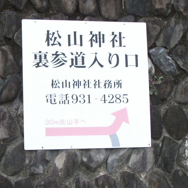 神社の参道とはとても思えないような道をしばらく歩くと墓地とミカン畑が見えてきます。
そしてそこにこのような看板があるので、道を間違ったわけではないのだとほっとするわけですが……
神社の参道とはとても思えないような道をしばらく歩くと墓地とミカン畑が見えてきます。
そしてそこにこのような看板があるので、道を間違ったわけではないのだとほっとするわけですが……
As you go down the street there is such a sign. This sign reads "a path back to the shrine".
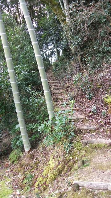
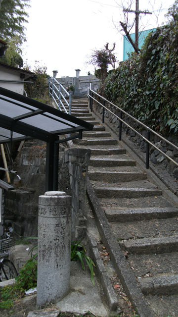
その先に待受けているのがこれです。もうこの時点で嫌な予感しかしないんですけど、これを登れと?
Proceed along this street and climb the stairs in the mountain.
上の写真の位置から石段を右へ左へと昇っていくと神社の裏手にでます。
Take the long stairs and you will reach the left side of this shrine.
もう少し下がって門の写真も撮影。
門前からは松山城の北東側、祝谷や一万といった地区の街並みが見られます。
Overlooking the city from the gate of the shrine, you can see the northeast area of Matsuyama Castle. Unfortunately Dogo Onsen can not be seen from here.
地図を見るとまっすぐ下向きに線が伸びているのでこの石段を降りるのかと思うのですが、それでは不正解です。
It seems to get off this staircase to advance to the next destination, but that is a mistake.
上の写真の石段の途中にお手洗いがあるのですが、実はその脇に常信寺への抜け道の案内があります。 地図に書かれてるルートでは神社から左上にぐるっと回って寺の左側に出る謎のルートがあるのですが、 多分この抜け道を指しているのではないかと。
When I get off the stairs in the photo above, there is such a guide on the way. You can proceed to the next destination "Joshinji" by following this hidden road.
本当にここでいいのだろうかと自信がなくなっていきますが、構わず突っ切ります。
I do not think this road is the correct route, but I advance without any concern.
もはや道としての機能を失いつつある階段を降りると常信寺の裏手の墓地に出ます。 この画像は墓地に出てから振り返って撮りました。
ここまでに巡ってきたお寺と比べても十分にご立派な境内。
そしてご立派な門。
秋山好古や俳人、中村草田男が葬られている墓地。
A cemetery buried in Ehime prefecture, Akiyama Yoshifuru and a haiku writer Nakamura Kusatao is buried.
常信寺から風俗街に降りた後、道後山の手ホテルで左折してまたもや急な坂を延々登ることになるのですが、 墓地への入り口は細い階段なので見落としやすいです。「道後村めぐり」のスタンプを目安に探してください。
Since this cemetery is located beside the hotel street, transportation is good, but it is easy to overlook because there is no noticeable conspicuousness. The place that climbed the stairs along the handrail on the left side of this image is the cemetery.
秋山好古の墓所ですが、意外と小さいものです。 目印なのか、左側に紅白の旗が掲げられていました。
This is the tomb of Akiyama Yoshifuru. It is surprisingly small. To be a goal, flags of red and white were raised.
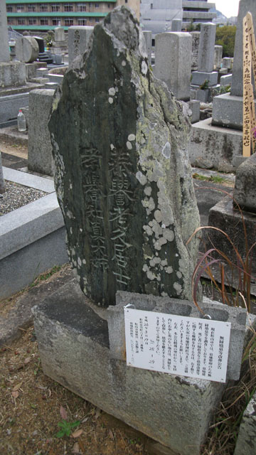
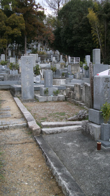
特に観光的なものではないのですが葬られている方の親族が亡くなったなどの事情で 無縁仏となった墓地。
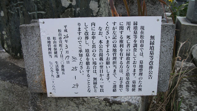
身内のいなくなった墓地は遺骨を取り出して墓は始末されるという……。世知辛い、世知辛すぎる。
鷺谷墓地からホテル街をぐるっと回って道後温泉の裏手を回って次の目的地、
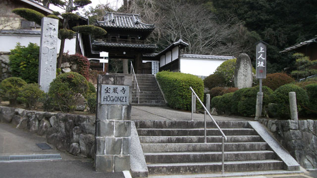
When you walk through the streets lined with hotels and small meal shops from the back of Dogo Onsen, you reach the next destination "Hogonji" and "Isaniwa Shrine." It is better to proceed from Dogo Onsen bypassing around because you have to walk a narrow road, which is quite difficult to understand as you follow the route of the map.

民宿街側の入り口にはこのような石碑が建てられているのでとてもわかりやすいです。

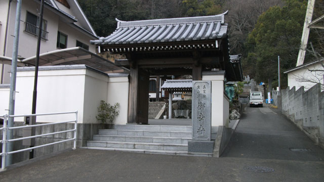
宝厳寺から民宿街を南進すると、先日初詣に行った伊佐爾波神社です。
ここまで来たら後はゴールを目指すだけ! 伊佐爾波神社の脇の道に入り、テニスコートの隣の道からハイキング道?に入ります。 途中に「風土記の丘マントーラ」なる施設があるのですが、今回のルートの進行方向では 途中で振り返らないと入り口を見落とす角度になってしまっていて完全に見落としてました… そのうちまた行こう。
It is a little more to the goal. Go along the mountain from the side aside "Isaniwa Shrine" and walk hard towards the goal "Ishiteji Temple".
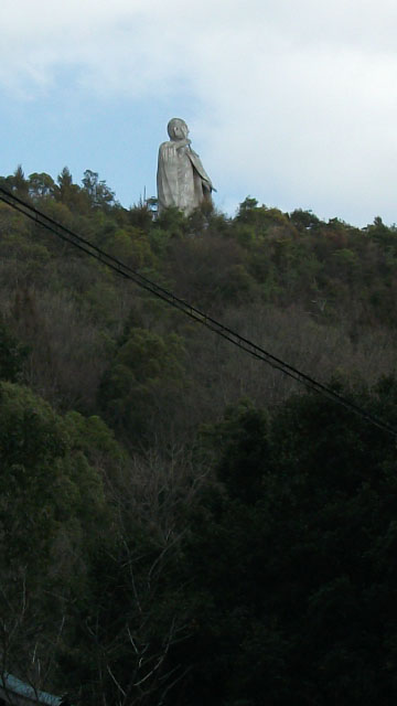
またオープンワールドのオブジェクトっぽい像が……体は中国の方を向き、頭はインドの方を向いているという弘法大師像なのですが インドの方向いてるかな…南向いてるような気がするんだが……
There is a statue of Kobo Daishi in the upper part of the mountain. This statue is said to be facing the Chinese direction, the head is heading toward India. However, I think that my head is facing south and not India.
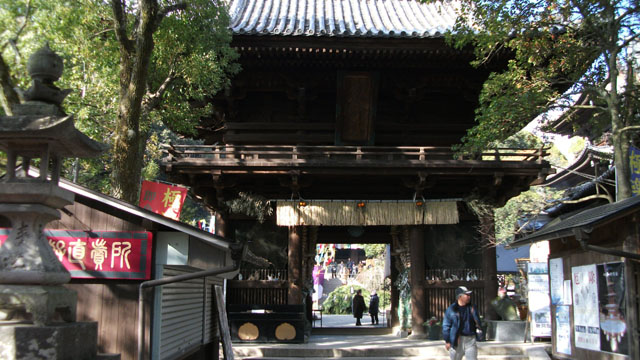
ゴールの石手寺。 お正月以外でも参拝客は多く、この日も人がいっぱいで線香の香りがいい感じに漂ってました。
This is the goal "Ishiteji Temple". A lot of people always visit holidays. And a good scent of incense sticks is drifting.
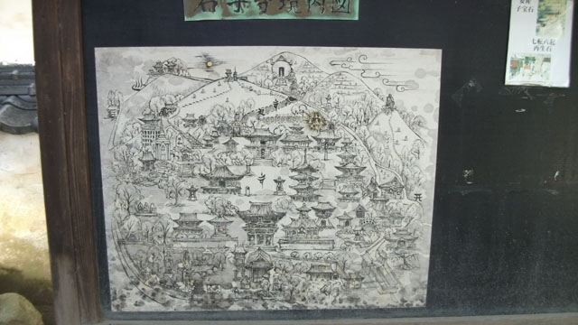
石手寺案内図と名づけられた図。 左上の温泉マークは道後温泉でしょうか。上部中央の山の前にある球? は「風土記の丘マントーラ」に飾られている宝珠のようです。 右側の山の上にいるのはオープンワールドの弘法大師像ですね。
Pictures that imagined "Ishiteji" are decorated. It is a picture symbolizing the facilities around this temple.
最初のルート図に全工程 10km、所要時間 3 ~ 4 時間とありましたが、GPSのログによると歩行距離 10.7km、総時間 2 時間 50 分だったので大体案内図通りでした。
The guide map of the route we saw at first saw "It took three hours". The actual walking time was 2 hours and 50 minutes, so this guide can be said to be accurate. However, it may take a longer time if you are older.
看板では気軽なウォーキングのように見えるのですが、実際にはルートの大半が山沿いなのでアップダウンが急で、 足腰と体力に自信がなければ全身の穴から血便を噴き出して死んでしまうのではないかという激しいルートでした。 休日にお気軽なウォーキングを楽しむのであれば、一度に全体を歩くのではなくいくつかに分割して周ると良いと思います。
Distance is good for hiking and holiday exercises, but since there are many intense slopes on the way, I thought it was an inappropriate course for the elderly. If you do not have confidence in your physical strength, I think that walking only halfway instead of walking the whole at once.