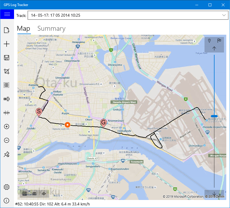
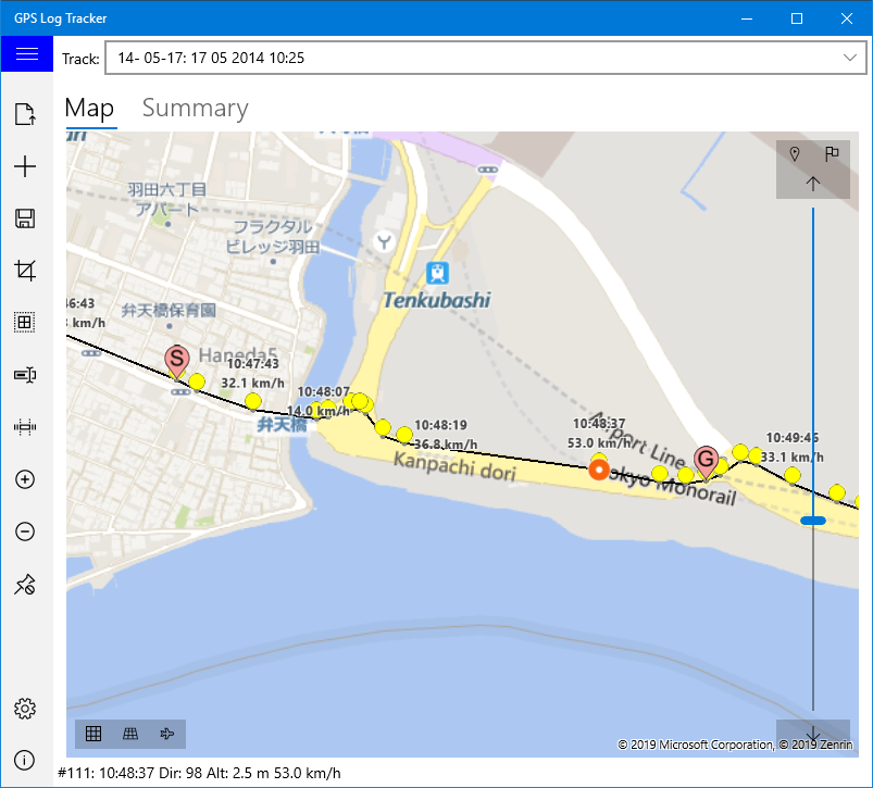
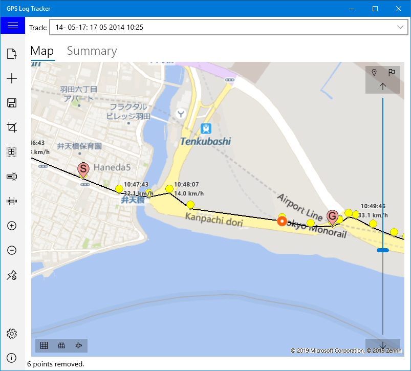
Start Position is displayed "S" on map, and End Position is displayed "G" on map.
This application displays and edits logs throttled by GPS. (Please note that this application does not measure position with GPS)
This application can read the log file recorded by GPS device (or GPS application of smartphone). The format of the corresponding file is as follows:
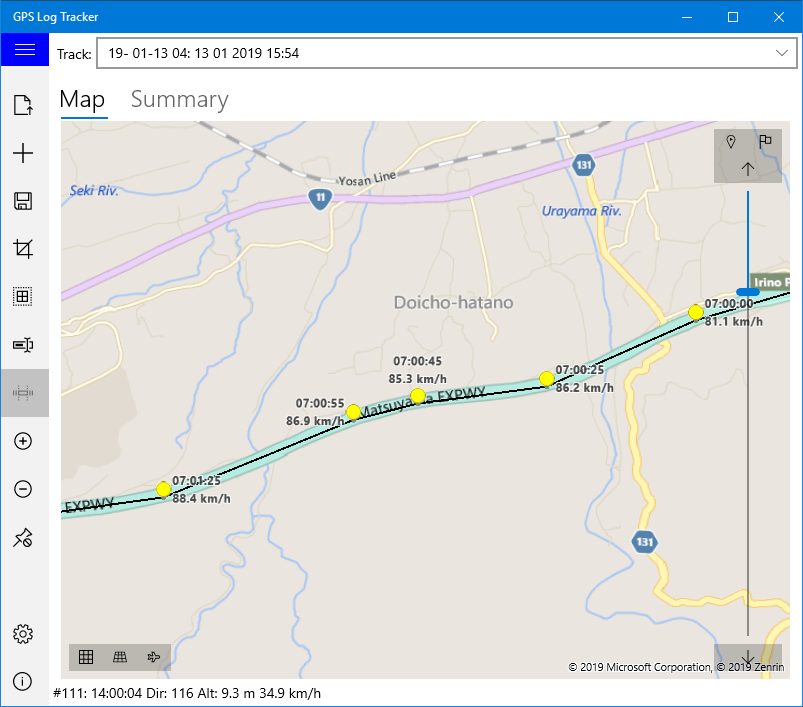
At the bottom left of the map screen there is a button to set the display mode. Also on the right side are a slide bar for editing the displayed route and a button for setting the selection range.
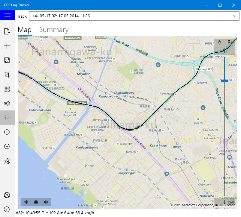
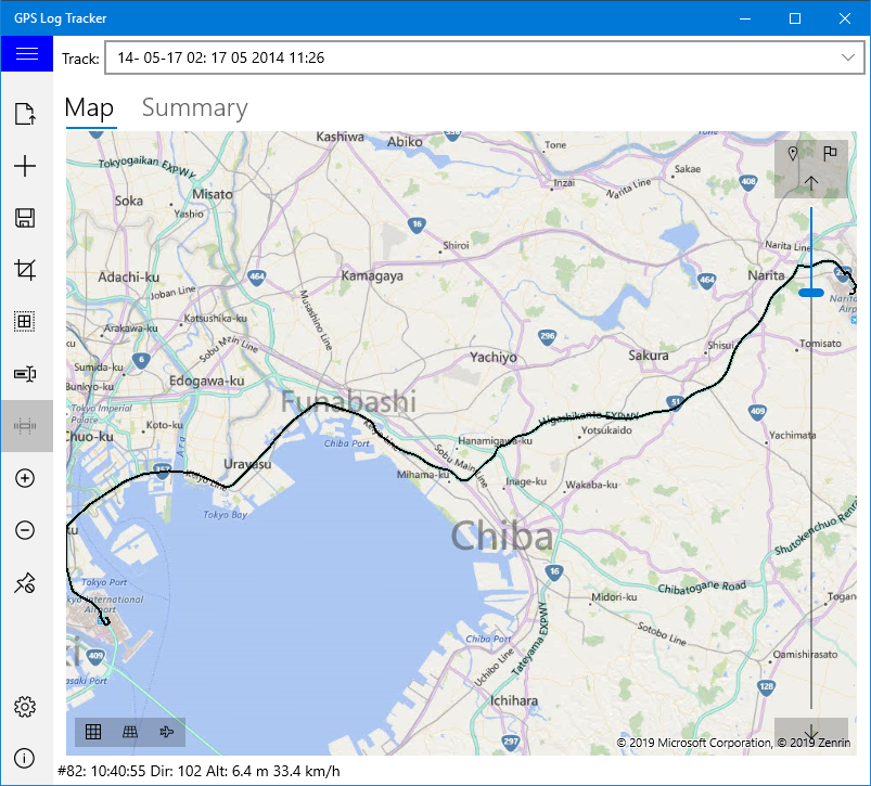
Pressing the "Show Entire Route" button reduces the map so that the entire currently selected route can be displayed on the screen.
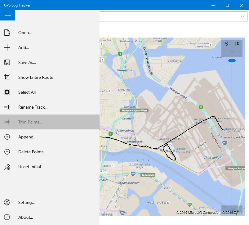
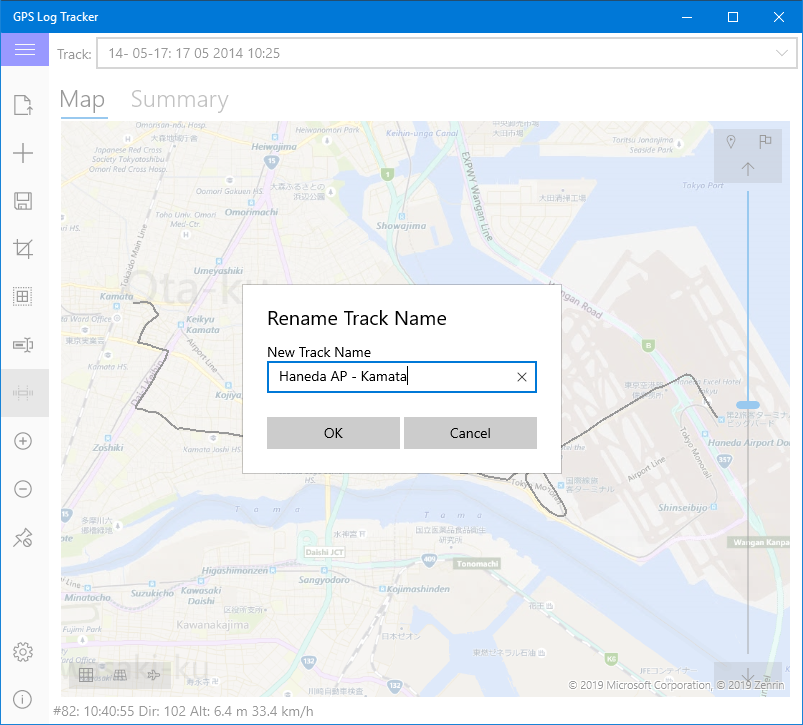
Change the name of the currently selected route. The changed name is used when saving this log.
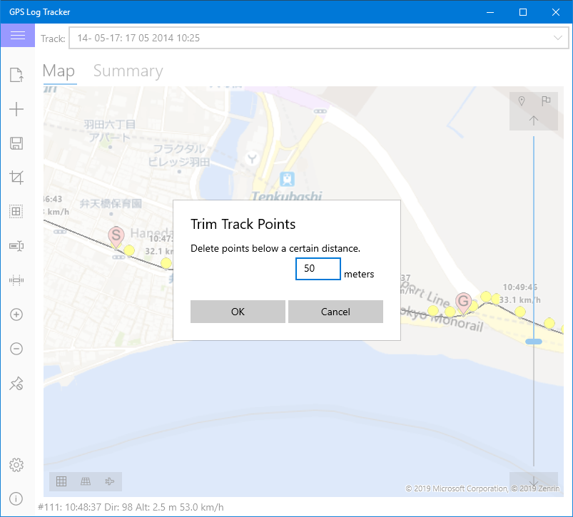
Delete points that are less than the specified distance between the two selected points. If many points are recorded at overlapping positions, such as temporarily stopping during positioning, you can use this function to delete unnecessary points.
Choise range by "Start Point" and "End Point" button.
Select "Trim Points" in the menu and enter the minimum point spacing in the displayed dialog box. The point where the point interval is shorter than the entered distance is deleted.
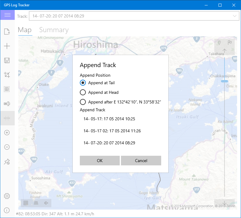
Combine another route information with the currently selected route information.
When a menu is selected, a dialog box opens, displaying a list for selecting a combination target and a radio button for selecting a combination position.
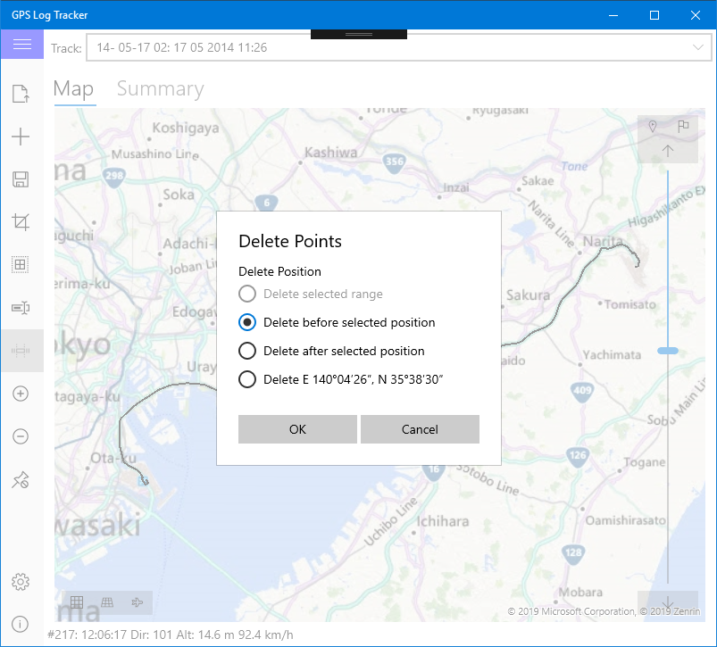
Delete the specified range or selected point on the current route. As with traveling near a building, this feature should be removed if unwanted points due to noise are recorded.
A dialog box opens when you select the menu. Select the method of deletion from the radio buttons displayed.
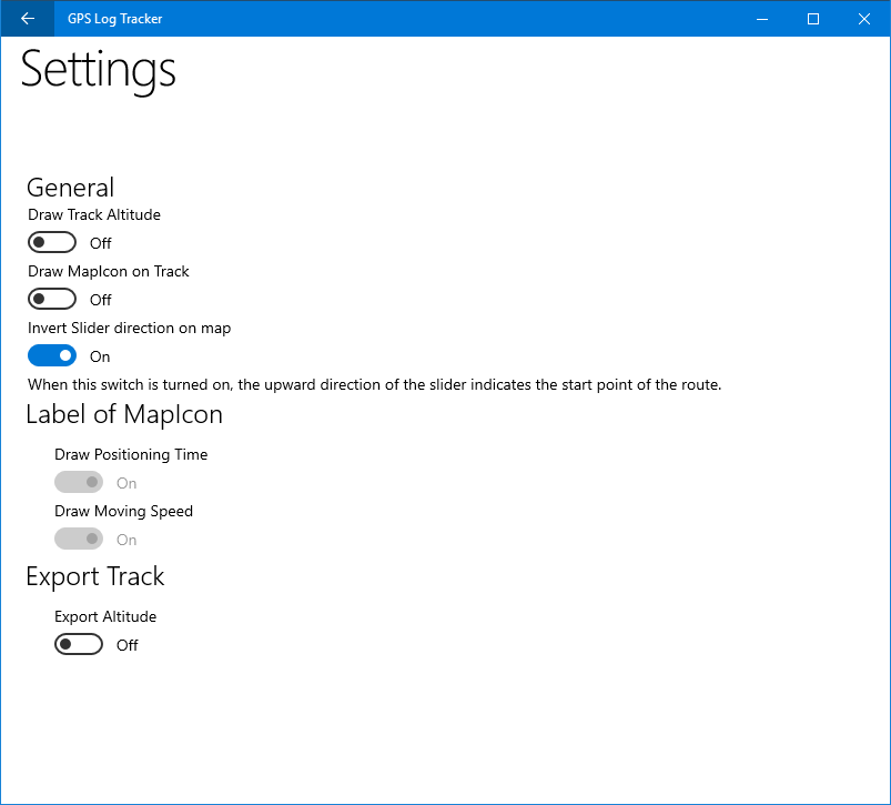
Change application settings on this screen.
At the moment there is only setting concerning display of points on the map.
Set whether to consider the altitude when drawing the route on the map. When the switch is off, all points are placed at ground level. When the switch is turned on, the points are placed relative to the ground.
Note: The current version does not correctly set the altitude when the switch is turned on. We are looking for a correction method.